Blue
Mountains mtb rides
The Oaks - Woodford to Glenbrook
Oaks track repairs Some grading work's been done (winter 2015), but I haven't ridden it to comment. The last two km of singletrack has been closed for June 2015 to correct erosion problems (yes, this is the bit that was realigned and completely redone to prevent erosion in May 2014 - what the?) This section of track is rated as "Blue - Intermediate", with a number of sections rated at "Black - Very Difficult". Detours (B-lines) bypass the hardest sections. Track head is NOT a toilet I know, you get off the train after a long trip, the station toilets are shut, you're busting for a leak, and the first patch of bush you see looks perfect. It's not. People live either side of the first 100m or so of the track, and can see further. What they don't want to see is you using their backyard, or very near to it, as a toilet. It stinks, is a health hazard, and has resulted in enough complaints that the cops are now patrolling. Get caught, get fined. Your choices are simple. Use the toilets on the train, or the toilets on the station (if open), or wait until you're far enough down the track that you can't be seen. Don't upset the locals - mtbers enjoy good relations with Blue Mountains communities, and would like to keep it that way. Thanks.
|
| elevation chart | ||||
| kml file | ||||
Introduction
I live in Woodford, so this was long one of my regular rides, and a favourite. The Oaks is rightly considered a classic Blue Mountains ride. I went through a period of hardly ever riding the Oaks, but recently rediscovered its joys all over again.
There are lots of tracks running off or just nearby that you can join with the Oaks for a full day out. NPWS have done a lot of work in recent years, extending the singletrack, adding signage, and officially declaring the track as "shared use" for cyclists and bushwalkers. This means you're now much more likely to encounter walkers than in the past. Be careful, slow down and say g'day when you encounter walkers - make certain we can continue to use the track.
The bush has recovered almost completely from the last fires - the singletrack's overgrown, and most of my photos no longer represent what you'll see.
The Oaks (and St Helena) were voted as NSW's most popular tracks by readers of Australian Mountain Bike magazine in 2004, probably making them the most popular tracks in Oz! You can see a lot of riders out there on the weekend, but midweek can be quite peaceful.
Here's a kml file that tracks my ride down on the evening of 12/06/2009 - right click to save as, then open it with Google Earth (assuming you've got Google Earth installed). I've also uploaded the file to Motionbased.com. Make sure you check out the elevation screen. I started at 631m at Woodford station and, despite 200m of climbing to get to the helipad, dropped to 74m by the causeway - but then I faced another 100m climb back to the station. If you have a compatible GPS, here's a gpx file - right click to save.
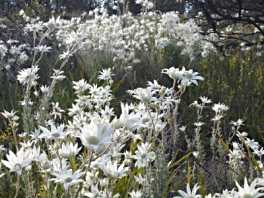
Nowadays, bushfire devastation on this track is only a memory, the bush rich and thick again with patches of flannel flowers (the floral emblem of NSW) dotting the open spaces in spring. Late October is time for flannel flowers and scented boronias. The 2013 fires did not come near the Oaks! |
|
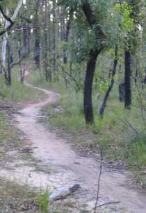
November 2014: the track's still pretty smooth on the flat bits, but loose, eroded and leaf littered on the downhills, although clearer lines have formed. You'll also find some sandtraps here and there.
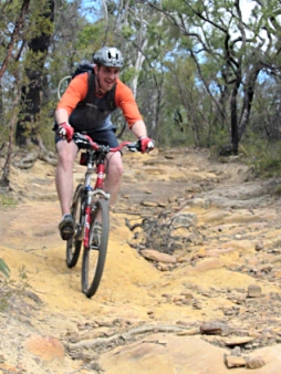
Some of the uphills are long and steep, particularly at the start and finish of the ride, but the long middle section is largely easy downhill. Beginners may find the early, steeper downhill sections a bit scary due to loose surfaces and possible high speeds, and should be sure to take it slow and steady (or walk) if at all worried. Although some hills may be big, and some bits might be a bit scary, don't forget that all bikes come with a very low gear - it's called get off and push! The singletrack varies from smooth and easy to sandy, rocky and technical. |
|
While the ride can be done from either end, it is much easier from the Woodford end. The big downhills become huge up hills on the way back - most of us can expect to walk! I know some fit buggers zoom up, but I find it takes me around twice as long to ride up as it takes to ride down.
Getting There
One of the beauties of this ride is it runs between Woodford to Glenbrook stations, so you don't need to bring the car at all. A lot of riders drive to Glenbrook, catching the train to Woodford. It can be a nice idea to have the car drivers meet the riders at Euroka clearing - a pleasant open picnic area where you can have a barbie (a sidetrack to the right off the main road). You'll have to pay the park entrance fee if you drive in - and remember to be out before they lock the gate at night - check the notice on the entry gate at the Glenbrook end. It's a big uphill ride from Glenbrook Creek to the park gates, just when your legs are at their tiredest!If catching the train, you'll need to use an interurban service (timetable) (they start from the Country platforms at Central Station) - look for trains going to Mt Victoria or Katoomba (Blue Mountains Line). Opal works. Some trains don't stop at Woodford, although most do, be certain or you'll face some road riding! When you get off the train, go to the Southern (high) side. Go down the stairs and turn left, admire the mural, then head up the stairs and ramp. Don't go down to the highway, unless you are going to the shop - the old shop, is... wait for it, A BIKE SHOP! Transit Espresso. Not a regular bike shop, but mountain bike hire and guiding, and a professional workshop, and cafe/restaurant. A pleasant spot to sit out on the verandah, enjoying a well earned coffee and cake after a hard ride Open Fridays and weekends only. I hope they do well - riders will be ahead if they do.
The station ramp takes you to Railway Parade which you follow towards Sydney, until it ends in a "T" intersection (about 300 metres from the station). Turn right here into the Appian Way, then left into Parker Street, after about 100 metres and left into Taylor Road at the "T" intersection (after about 80 metres). After another 50 metres, you'll see a dirt road off to the right, with a locked gate. There are signs here to identify the National Park. Lift your bike over the low fence and you're away! NPWS have thoughtfully installed a fresh water tap just inside the gate - don't steal water from the neighbours! |
If coming by road, head west towards Katoomba on the Great Western Highway. About 11 - 12 kms past Springwood, you'll need to take the Appian Way turnoff from the highway (in the winding section). This is well signposted as "Railway Station" on a large blue sign. Turn left over the railway line at the top of the hill (the first "T" intersection mentioned above) and then follow the directions for train travellers.
You could combine the two and drive to Glenbrook - turn left just after the information centre and before the lights, turn left again and immediately right (if you miss this turn, just take the next one). These roads run to the station - where there's a parking area and street parking available. Don't leave valuables in your car - thieves have worked out they have plenty of time before riders return.
I wasn't going to tell you exactly where this is - but bah - it's got a signpost now, I'm sure you'll work it out.
Ride Description
Most of the track's in very good condition - but some of the singletrack will be a bit rough for beginners. The firetrail is reasonably smooth one the flats, but very sandy in patches. The steep downhills may be very loose and eroded. Indeed, in November 2014, the steeper downhills were very loose and eroded, with a main clearer line the only respite. Apart from sections of singletrack, and the steep downhills, the ride is not technically difficult. The steeper downhills can be nasty at speed - at times they are badly eroded and many have an unexpectedly sharp corner to catch the unaware. Whenever you see signs warning of "humps", you'll see a waterbar, but there's usually a nasty corner nearby - not all corners have a hump or a sign.
Although the track is closed to vehicles for the first 20 km or so, keep your ears open. Occasionally motorbikes go round the gates and I've seen 4WD tourist operators, NPWS, police, ambo's and firies out there over the years. Riders have been hit by motor vehicles on this track. Keep your eyes and ears wide open!! They may be uncommon, but you can often see where they've been - recently. You also need to watch for bushwalkers and other cyclists - especially in view of the speeds that can be reached in some sections!
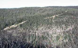
The first three kilometres are pretty easy, mainly flat or downhill, with a few small climbs. Watch out for some corners that can catch you unawares - the aptly named Crash Corner in particular... From three to 11 kilometres, the track climbs up and down several steep hills, cruising along ridgetops in between - great views over the bush and to the city can be seen. In spring you will see and smell lots of boronias along here.
At around the three kilometre mark, you'll climb a short steep hill to the "BMX track" - a small clearing with some dropoffs - before heading down a steep, fast, loose downhill - with a tricky left hander halfway down, and a 90 degree sandy left at the bottom. High speeds can be reached on this hill without trying - be careful, it's easy to lose it here.
| The very next climb takes you to "The Circles" - an Aboriginal engraving carved on a rock shelf to the right. You can also find some axe grinding grooves on this rockshelf. On a clear day, you can see Sydney from here - through the trees. | 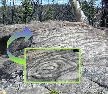 The Circles are visible from the track |
NPWS have pushed up
a lot of boulders to discourage people from riding on this site. DON'T ride on it! Sheesh... |
About a kilometre past The Circles you'll see a track to the left, this is the St Helena track, a fun, out and back track to a couple of lookouts. Some steep descents on the way out (climbs on the way back) but OK for confident newbies since grading in 2010.
A few kilometres later, at the top of the next major hill, you'll see some big rock shelves to the left, which offer great views to the city on a clear day. Shortly after this section is the steep and fast descent into Deadman's Corner and down Redwire Saddle. Deadman's Corner is the nastiest hairpin corner on the track (complete with a "hump" sign). If you miss this corner and run ahead over the lookout... well, it was nice knowing you... Seriously, be careful, this corner is the scene of many a crash. Redwire itself is another downhill where silly speeds can be reached with little effort - again, be very careful. My own bruising after a fast off here was something to behold...
 panther country? |
The track to the left at the bottom of the saddle goes to Toby's Glen. I also know this spot as Panther Crossing, after a large black cat ran across the track in front of me. One of the infamous panthers supposedly roaming the mountains? Pfffft. I don't believe that rubbish, but I'm sure it was a cat, and big <cue Twilight Zone theme>. Finish the climb out of Redwire and the worst of the climbs are behind you, as the hills mellow and the ride gets ready to shift into downhill mode. |
| The downhill stretch actually starts at "The Wheel". First you'll come to a large clearing on the track (the helipad), and then a short downhill and small climb where you'll see an old blue wheel stuck in the trunk of a tree - it's been there so long the tree has grown around it and it's marked on the topo maps. The Wheel was originally mounted by bushwalkers to mark the hub of the Blue Labyrinth's ridges, which radiate spoke-like from this point. As soon as you ride up Underpants (the hill past the wheel), you're off!! Watch out for the nasty right/right/hard, loose left corner after the hump! It's very easy to get into these corners waaaay too fast - the number of skidmarks left on the track provide ample evidence of riders leaving skidmarks in their pants... | 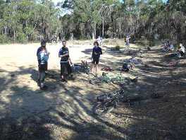 the helipad is a popular spot for a break and signals the downhill's about to start |
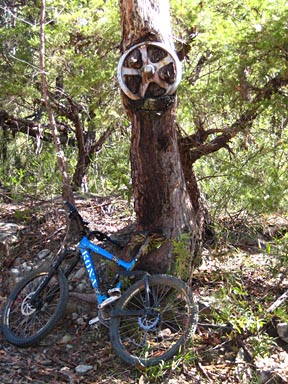
the wheel is still very much there
YEEHAAA!!
The next five kilometres are all smooth and fast downhill!! (well, there are some short flats and uphills, but nothing much). The downhill section isn't steep, but speeds of over 50 kmh can be hit and maintained, higher speeds with some work. After riding about 18 kms from the start, you reach the second locked gate, ending Stage One, or the firetrail section of the ride.
Now the singletrack begins. Woohoo! You can still ride the main firetrail rather than the singletrack, but why would you bother? Cars use it, it's corrugated, and the singletrack's much more fun! Just to the left of the locked gate there's another gate in the wire fence. Ride through here to see the large sign laying out the track rules. Follow the singletrack away from the firetrail, until you reach a stop sign. Yes, I said a stop sign, where you cross the Red Hands fire trail. Cars won't be expecting you to pop out of the bush in front of them here, hence the stop sign. Look out!
After crossing Red Hands fire trail, you'll pass the Oaks picnic area on your right - a good spot for a break, with its shelter shed and newish long drop toilet. Fresh water is no longer available at the picnic ground.
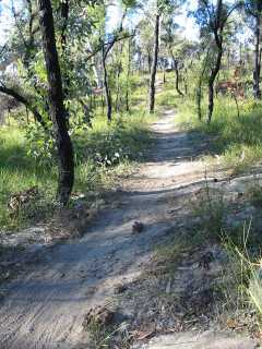
The singletrack continues on a mainly downhill run on what we called the "Twitter trail" (or sometimes "Pinchflat", for reasons which may become obvious...), running roughly parallel with the main firetrail until you rejoin the road. This isn't a very steep singletrack, but it can be rough at times - don't forget you have a number of bail out points at cross tracks - turn right to get on the main road and turn left when you hit it. The singletrack's quite sandy in spots, and may have plenty of loose and rocky sections.
DON'T make new tracks by cutting corners - straight singletrack is boring! |
|
<rant>Over the years the singletrack has been slowly straightened. I don't know if it was riders, walkers, NPWS, or just someone who scored a chainsaw for Christmas. Whatever, it's clear they don't "get" mountain bike riding. Sections that were beautiful flowing singletrack, swinging from side to side, are now almost straight - nowhere near as much fun! Trail gnomes tried to arrest the changes, but were beaten by the sheer doggedness/foolishness of the straightening crew. I really don't understand why anyone would prefer to ride in a straight line, but it seems many do. </rant>
|
|
Now I've stopped ranting, I should say that it's still a fun ride. This singletrack eventually ends on a narrow firetrail, which you follow until a signed NPWS singletrack heads off to the right. The new track runs all the way to the carpark above the causeway. It's rated as technical as IMBA black (very difficult) with blue (intermediate) options (B-lines). |
|
This new track is fairly wide, hardpacked, groomed singletrack, with a few obstacles for more advanced riders. I found I was on and off the brakes, and out of the saddle a lot, as the track wound its way up and down, round and round, across many waterbars and around many berms. Although it appears to be well constructed and erosion resistant, it's very different to the more natural rest of the singletrack. Still fun, but not what I expected. Could a confident beginner handle it? The ratings apply to the technical sections and there are some steeper sections, both of which could be walked, but if you're at all concerned, head back down the firetrail until you reach the road (100m or so past where you joined the firetrail earlier), and turn left. |
|
|
I rode most of the black lines, and by the time I reached the carpark I had sore legs from standing up so long! With all the changes made by NPWS, we can now ride all the way from the gate to the Little Moab carpark on motor vehicle free tracks, with all bar a few hundred metres of that being singletrack. Cool.
|
DON'T
make new tracks if you can't ride what's there - |
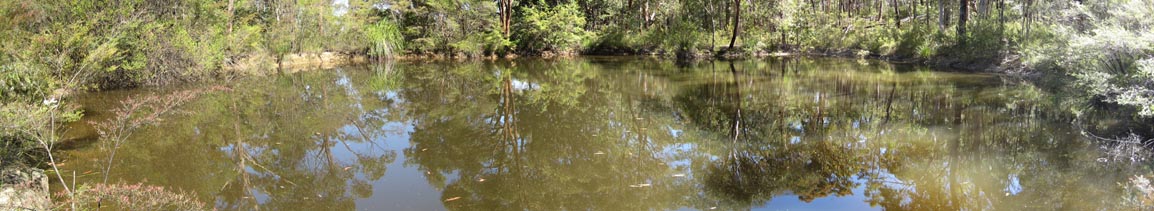
After you cross the creek, there's a final huge uphill to the top of the ridge, which sees you out of the National Park. Stay on this road to run straight to the station and carpark.
Beware! After heavy rain the creek crossing may be impassable - it's a long ride back to Woodford! |
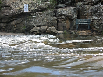 sometimes there's a lot of water over the causeway |
Traditionally the ride finishes with something nice and fattening from the Glenbrook cakeshop. Good riding, a few mates, and cakes. What more could you want? We've got that too! There's a pub about five minutes ride up the highway...
An excellent and really different option for this track is to ride it at night, great fun!
Night really adds an extra element of
Video
Two videos of the ride - one of the firetrail, and one of the singletrack. Videos of other mtb rides (and some moto rides) can be found at my YouTube channel.
Side Trips
The Oaks side trips now have their own page.
Woodford to Glenbrook Cycle Classic
Woohoo! The race now has it's own page as well! Results and pix at Careflight. If you were there, your pic may also be at Pixelpics - mine is!
Other Stuff
Don't drink the water from any creeks - it's polluted - take your own. Tap water is available at the Woodford and Glenbrook park entrances.You're in a National Park - no dogs or other domestic animals, ride responsibly and take your bloody rubbish OUT with you!! Don't ruin it for everybody!
in 2014 I'm keeping the rating for this track to three and a half Fat Hippies for advanced riders (riding at night scores 4). Wear and tear on the steep hills has reduced beginner friendliness - I'd rank it at three and a half Fat Hippies for beginners, and even then, more confident beginners.
beginner rating - ![]()
![]()
![]()
![]()
All rides are now rated in Fat Hippies - one means grab a slice of pizza and stay on the couch, two means not bad, three means well worth a ride, four means a great ride and five means stop looking at your computer, go ride it!
| Distance | ~28 km station to station |
| Difficulty | Medium/Hard - may need to walk some uphills, especially that last climb from the causeway. Surface may be loose and corners rutted. Causeway may be impassable after heavy rain. Front suspension is recommended, and a duallie would be better in the singletrack. |
| Time | Varies - 1 hr 30 minutes upwards, riding straight through. Add time for any sidetrips, munchie and wee breaks. My son and I took about 4 hours, including stops, when he was 10. |
| Trains | Woodford, Glenbrook |
| See also... | Anderson's fire trail, Murphy's Glen, Ingar, St Helena, try it at night! |
| Interest | lookouts, spring flowers, Red Hands Cave, swimming holes, bushwalks, other tracks, picnic areas, Aboriginal Engravings, the Wheel, Euroka, the Oaks Classic Race, Nepean Lookout, other side trips |
| Ridden | November 2014 |
| Reviewed | 2014 |
![]()
another fAt hIpPy production
