Blue Mountains mtb rides
Murphy's Glen - Woodford
Murphy's Glen is another short mid mountains ride. It could be combined with either Anderson's fire trail, Woodford to Glenbrook (The Oaks) or both (if you still have the energy...), or on its own.
Murphy's Glen is reached from the southern side of Woodford station by heading up Bedford Road which goes all the way to Murphy's Glen. Bedford Road runs for one kilometre before the tar ends with a short sharp steep downhill. Continue on straight ahead.
Go through the National Park gate in another 3/4 of a kilometre, following a brief downhill. Sometimes this gate is locked - they claim in bad weather or emergency, but it's been open in appalling conditions and closed in good conditions, so I'm not sure how they judge. The track is a mix of hardpack and loose sand over hardpack as a result. Because cars are allowed in, corrugations appear on some corners, and you'll face the obvious car/bike dangers - keep your eyes and ears open, especially on the fast downhill to the Glen. January 2015 update: The gate is closed while the track is being graded.
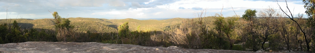
Look out for Linda Rock - on your right on the way in, as the track takes a long right hand corner. Linda Rock has great views to the east - there's a bit of a track running off the road onto the rock, which is a large, stepped sandstone shelf. A small cairn used to be at the top, but it has been destroyed in recent years. Unfortunately, my photos don't do the view justice. A nice spot to sit and meditate, especially on a clear night, when you can see the lights of Sydney sparkling in the distance. On a clear day, Sydney Tower (Centrepoint) and the Harbour Bridge come into view. Back in the old Y2K "end of the earth" hysteria days, I found a survival camp set up out here. Believing that discretion is the better part of valour, I didn't hang around that day, and there's no sign of it now.
|
After about 2.5 kms, you'll see a walking trail to the left, signposted as the Turpentine Walk. This track also brings you out in Murphy's Glen. Please note that this is officially a walking track, therefore bikes aren't allowed. I have walked it, and although sections are certainly rideable, much of it is very steep and blocked with logs and branches - if you do try to ride it, expect to spend a fair bit of time off your bike, or even worse, carrying it! Another 500 metres sees a road off to your right, signposted to Bedford Creek. This track is also marked walkers only, but is in fact the end of Anderson's fire trail, and is a wide, steep firetrail, usually in excellent condition. The descent to Bedford Creek is fun, and I really enjoy riding beside the creek, listening to the bellbirds.I don't enjoy the climb/walk back out. |
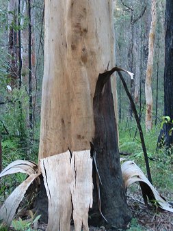
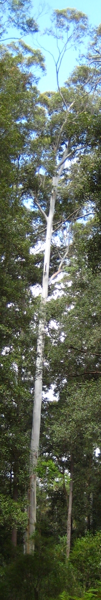
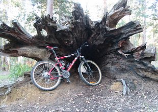
Straight ahead is the long (1.1 km), steep hill taking you down to Murphys Glen. Veer left at the bottom into the upper camping area, complete with campfire and cooking areas, toilets and water. The end of this camping area is only another 500 metres, and it looks like a very pleasant camping or picnic area. There are some huge hollow logs (you could easily sleep a few people who don't mind creepy crawlies in one) and lots of huge trees. There's also lots of birdlife to hear. It's possible to hit high speeds down this hill, even without trying. But it's open to traffic. Don't forget to watch out for cars and walkers and keep to the left side of the track. I don't want to hear stories of human hood ornaments... |
|
If you turn right at the bottom of the hill instead, you go down to a much smaller campsite picnic area and the remains of a dam. A stretch of singletrack leads to an unofficial camping area and a small creek.The singletrack does continue after the creek, but isn't good riding. According to my map, this track leads to a pool on Bedford Creek.
Unfortunately all good things come to an end, and you have to return the way you came in. That big downhill is now an uphill, with a climb of 120 metres just to the Anderson's fire trail turnoff, with almost 100 metres of climbing in the first 500 metres. Although there are a few downhills, it's mainly uphill all the way back to Woodford.
Linking with other rides:
It's probably better to do Murphy's Glen before The Oaks, if you are going to ride the combination. Follow the above directions from the station, on your return, follow The Oaks directions from the station.From Anderson's fire trail, turn right at the top of the big hill out of Bedford Creek and just follow the trail to the Glen.
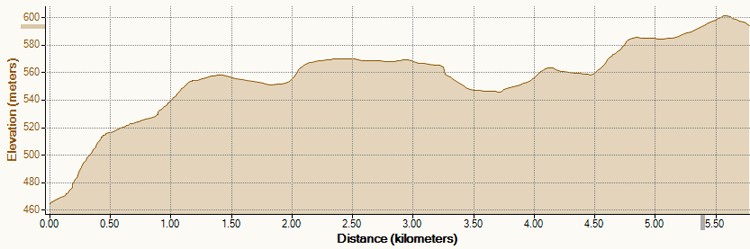
from the old dam wall at Murphy's Glen to Woodford station - all those fast downhills have turned into steep climbs...
| Distance | approx 14 km return |
| Difficulty | Medium/Hard
- may need to walk some uphills, huge uphill from the Glen itself. Surface may be loose. |
| Time | Varies - takes me over 1 hour |
| Trains | Woodford - timetable |
| Maps | Jamison 8930-II-N, Katoomba 8930-I-S topographic maps |
| Reviewed | January 2015 |
| See also... | Woodford
to Glenbrook Fire Trail, Anderson's Fire Trail,
Bedford Creek, some sidetracks |